SANDY
(Photo American Tower Corp)
Sandy:
Type: Repeater
Location: Northeast end of Alford Mountain. About 30 miles northeast of Barstow. Remote
Paths: Turquoise and Cline Springs
Notes:
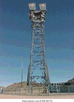
SAN MARCOS
(Photo American Tower Corp)
Type: Repeater
Location: east end of the Merriam Mountains about 3 miles north of San Marcos.
Paths: Julian, Black Mountain and San Clemente
Notes:
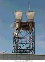
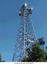
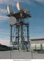
SANTIAGO PEAK
(Photo American Tower Corp)
Santiago Peak
Type: Repeater
Location: Atop Santiago Peak in the Santa Ana Mountains. About 15 miles south of Corona. Remote
Paths: San Bernardino, Box Springs, Boucher Hill, Anaheim and Los Angeles 03 Madison
Notes: One of the larger repeaters in the Socal system. Its height (5600 feet) made it capable of "seeing" many other sites and it became an important link in the San Diego-Inland Empire and west-east microwave routes.
SHEEP HOLE
(Photo American Tower Corp)
Sheep Hole
Type: Repeater
Location: At Sheep Hole Pass near the north end of the Sheep Hole Mountains. About 20 miles northeast of Twentynine Palms. Very Remote
Paths: Granite Pass and Belle
Notes:
SHIRLEY PEAK
(Photo American Tower Corp)
Shirley Peak
Type: Repeater
Location: Atop Shirley Peak in the Green Horn Mountains. About 40 miles east of Delano. Very Remote
Paths: Bird Springs and Mt. Adelaide
Notes:
STRAWBERRY PEAK
Type: Switched/Junction
Location: Atop Strawberry Peak, about 2 miles west of Rimforest and about 15 miles north of San Bernardino.
Paths:Cline Springs, Keller Peak, San Bernardino, Corona, Padua Hills, Phelan and Table Mountain.
Notes: A very important junction in the Southern California Microwave switched network. For more information and pictures see: Strawberry Peak
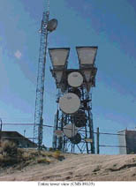
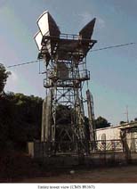
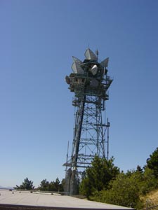
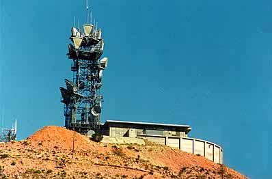
TABLE MOUNTAIN
(Photo American Tower Corp)
Type: Repeater
Location: Adjacent to Table Mountain in the San Gabriel Mountains. About 3 miles north of Wrightwood. Remote
Paths: Strawberry Peak and Hauser Mountain.
Notes: Another high site at 7400 feet.
TEHACHAPI MOUNTAIN
(Photo American Tower Corp)
Type: Repeater
Location: Atop Cottonwood Peak in Rancho Castaic about 50 miles north of Los Angeles.
Paths: Oat Mountain, Whitaker Peak and Buena Vista.
Notes:
SLATE
(Photo American Tower Corp)
Slate
Type: Repeater
Location: Slate Range Mountains about 7 miles southwest of Trona. Remote
Paths: Owlshead and El Paso Mountain.
Notes:
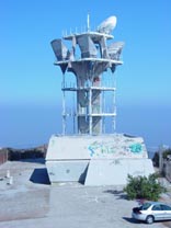
TOPANGA RIDGE
(Photo McCullough Comsites)
Type: Repeater
Location: Northeast of Saddle Peak in the Santa Monica Mountains. About 5 miles southwest of Topanga. Remote
Paths: Los Angeles 09 (Richmond), Los Angeles 07 (Airport) and Hall Canyon
Notes: A rather recent site built after 1979 to channel traffic from
Los Angeles west to the "coastal" microwave route through Hall
Canyon. A interesting design includes stylized concrete tower and
trapezoidal shaped equipment building. Probably designed as to
minimize impacts to the surrounding area. Unfortunately entire site
(including horns) has been 'tagged" by graffiti artists
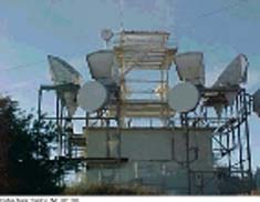
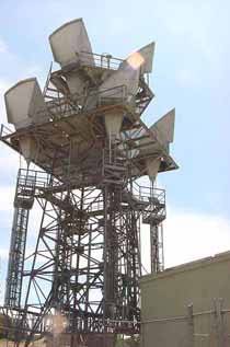
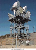
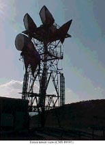
TURQUOISE
(Photo Daryl Gibson)
Type: Junction/Switched
Location: Atop Turquoise Mountain, 15 miles north of Baker. Remote
Paths: Potosi Mountain (Nevada), Mountain Pass, Kelso, Sandy and Ibex
Notes:
WARNER SPRINGS
Type: Repeater
Location: Just west of the Chihuahua Valley and about 8 miles north of Warner Springs. Remote
Paths: Julian and Wildomar
Notes: A "typical" microwave repeater site.
For more Warner Springs pictures
WHITAKER PEAK
(Photo American Tower Corp)
Type: Repeater
Location: Atop Whitaker Peak in the Tehachapi Mountains. About 10 miles northwest of Castaic.
Paths: Newhall and Tehachapi Mountian
Notes:
WILDOMAR
(Photo American Tower Corp)
Type: Repeater
Location: Just north of Bundy Canyon in the Sedco Hills. About 3 miles
east of Wildomar.
Paths: Sage, Warner Springs and Corona.
Notes:
Yuma
Type: Junction/Switched
Location:
Paths: Glamis
Notes: Although not part of the California microwave system, Yuma is located about a mile east of the California border and is an end office which connects to a California site.